Are you ready to hit the trails on an unforgettable adventure through the Great Smoky Mountains?
If so, you’re in the right place.
With over 800 miles and 150 unique trails, Great Smoky Mountain hiking trails offer something for everyone, from casual hikers to experienced backcountry explorers.
However, with so many trail options, it can be hard to know which one to take, so we created this list highlighting the 12 best Great Smoky Mountain hiking trails. Ranking the trails by difficulty, from easy to difficult.
So whether you’re seeking a leisurely walk near Gatlinburg or an epic trek deep into the heart of the Smokies, we’ve got you covered with detailed trail descriptions, key features, difficulty ratings, maps, and elevations.
Great Smoky Mountain Hiking Trails:
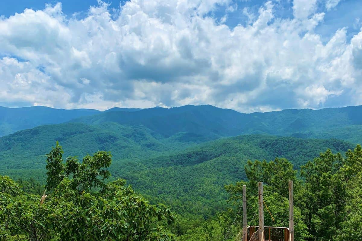
The Great Smoky Mountains, straddling the rugged border between Tennessee and North Carolina, are among the oldest mountain ranges in the world.
With 71 miles of the iconic Appalachian Trail winding through the park, it’s no wonder that the Great Smoky Mountains are widely regarded as one of the top hiking destinations in the eastern United States.
1. Baskins Creek Falls: For Waterfall Lovers
Key Specs
- Difficulty: Easy
- Length: 3.0 Miles (Out and Back)
- Elevation Gain: 953 Feet
- Trail Location: Roaring Fork Motor Nature Trail
- Features: Waterfall, Seasonal mountain views, Small creek, Baskins Cemetery
Baskins Creek Falls, also known as Baskins Falls, is a hidden gem in the Great Smoky Mountains that often gets overlooked. This easy 3-mile roundtrip hike is one of the shortest and most manageable Great Smoky Mountain hiking trails with the added bonus of a stunning waterfall.
Rated as an easy hike with a total elevation gain of 953 feet, the last 50 yards leading down to the falls can be steep and rugged, however, requiring extra caution. Also the return trip involves a somewhat challenging climb back, due to the rapid descent on the way to the falls.
Along the trail, hikers can enjoy occasional mountain views to the west and glimpses of Gatlinburg, particularly during winter or early spring when foliage is less dense. The main attraction, however, is the impressive Baskins Creek Falls at the end of the trail. This underrated waterfall is a perfect spot to relax, take in the natural beauty, and even enjoy a picnic lunch.
The trail also offers interesting historical tidbits, such as the origin of the falls’ name, which is believed to have evolved from a local hunter known as “Bearskin Joe.”
2. Gatlinburg Trail: A Riverside Stroll with a Glimpse of History
Key Specs
- Difficulty: Easy
- Length: 3.9 miles (Out and Back)
- Elevation Gain: 235 feet
- Trail Location: Gatlinburg / Sugarlands Visitor Center
- Features: Stream, Water views, History
The Gatlinburg Trail is a nice 3.9-mile out-and-back hike that starts near the entrance to the Great Smoky Mountains National Park.
This extremely popular, relatively flat gravel footpath follows the West Prong of the Little Pigeon River, offering a peaceful escape from the bustling town nearby.
As you walk along the trail, you’ll find several access points to the river, where you can dip your toes in the water or simply enjoy the soothing sounds. Plus, benches are strategically placed along the path, allowing you to take a moment to appreciate the surrounding beauty.
Also, the Gatlinburg Trail is one of only two trails in the park that allow visitors to walk their dogs on a leash and ride bicycles.
At the half-mile mark, you’ll cross the river on one of the longest pedestrian footbridges in the park. As you continue your hike, you’ll pass remnants of old home sites, including rock structures and chimneys, offering a glimpse into the area’s history.
As you approach the end of the trail, you’ll pass park maintenance buildings and follow the Park Headquarters Road. At about 1.9 miles from Gatlinburg, you’ll find a side trail leading to Cataract Falls, a half-mile detour if you want to see the waterfall. The trail ends at the Sugarlands Visitor Center, where you can find restrooms, a gift shop, and a museum.
3. Goldmine Loop Trail: A Journey Through History & Nature
Key Specs
- Difficulty: Easy
- Length: 3.1 miles (Loop)
- Elevation Gain: 615 feet
- Trail Location: Lakeview Drive (Bryson City)
- Features: Historic, Lake views
The Goldmine Loop Trail is an easy 3.1-mile hike that offers a unique blend of history and natural beauty. With a total elevation gain of 615 feet, this trail is suitable for most hikers looking for a friendly outdoor experience.
Starting from the parking area at the end of Lakeview Drive, hikers begin their journey by walking through the impressive 1,200-foot-long Lakeview Drive Tunnel. This tunnel marks the end of the “Road To Nowhere,” a result of a controversial history involving the displacement of Swain County residents for the creation of Fontana Lake and the Great Smoky Mountains National Park.
After emerging from the tunnel, hikers will reach the official start of the Lakeshore Trail, the second-longest trail in the Smokies. Approximately two-thirds of a mile from the parking lot, the Tunnel Bypass Trail junction offers an alternative route for those who wish to avoid the tunnel.
Continuing on the Lakeshore Trail for another tenth of a mile, hikers will reach the Goldmine Loop Trail. Turning left, the trail descends steeply to the Goldmine Branch creek, where remnants of an old homestead, including a washtub and a crumbling chimney, can be found.
As the trail progresses, hikers will encounter a side trail leading to Backcountry Campsite 67 and a small cove along Fontana Lake.
The trail then begins a steady climb back up to Lakeshore Drive, passing through a section affected by a small forest fire that has opened up the canopy to reveal views of the surrounding mountains. At 2.7 miles, the trail meets the Tunnel Bypass Trail, where hikers should take a right to return to the parking area, completing the loop at 3.1 miles.
4. Laurel Falls: One of the Best Waterfalls in the Park
Key Specs
- Difficulty: Easy
- Length: 2.3 miles (Out and Back)
- Elevation Gain: 314 feet
- Trail Location: Little River Road
- Features: Waterfalls
The Laurel Falls Trail is one of the most popular and easy Great Smoky Mountain hiking trails that leads to stunning waterfalls. With a modest elevation gain of 314 feet, this trail is suitable for most hikers, including families with young children.
Built in 1932 to provide fire crews access to the Cove Mountain area, the Laurel Falls Trail was later paved in 1963 to address erosion issues. Today, it remains a favorite among visitors, so it’s best to start your hike early in the morning, during the early evening, on a weekday, or in the off-season to avoid crowds.
As you travel along the trail, be mindful of steep drop-offs, especially when hiking with children. The trail also passes through bear country, so stay alert and keep a safe distance from any wildlife.
When you reach Laurel Falls, you’ll be greeted by an impressive 80-foot waterfall, divided into an upper and lower section by a walkway crossing Laurel Branch at the base of the upper falls. The waterfall gets its name from the mountain laurel that blooms along the trail and near the falls in May.
For the best photos, consider taking your hike early in the morning or late in the day when the surrounding mountains provide ample shade. After taking in the waterfall, you have the option to continue along the Laurel Falls Trail for another 2.7 miles to visit the old fire tower atop Cove Mountain if you’re up for a more challenging hike.
5. Andrews Bald: A Hike to Panoramic Vistas
Key Specs
- Difficulty: Moderate
- Length: 3.5 miles (Out and Back)
- Elevation Gain: 899 feet
- Trail Location: Clingmans Dome Area
- Features: Panoramic views, Spruce-fir forests, Expansive grassy meadow
The hike to Andrews Bald is a moderately difficult 3.5-mile roundtrip through the Great Smoky Mountains, which offers breathtaking panoramic vistas.
With an elevation gain of 899 feet, this trail provides a perfect balance of challenge and scenic views.
Thanks to the efforts of the Friends of the Smokies and the Trails Forever program, the once rugged and rocky Forney Ridge Trail has been transformed into a more accessible and safer pathway. The multi-year project involved rebuilding the trail with flat stones, constructing staircases from locust wood and native rock, and installing drainage structures and elevated boardwalks.
The hike begins with a descent down the southern flank of Clingmans Dome, also known as Forney Ridge.
At various points along the trail, you’ll encounter junctions with the Clingmans Dome Bypass Trail and the Forney Creek Trail. To continue towards Andrews Bald, follow the signs and proceed straight ahead.
Upon reaching Andrews Bald, you’ll be greeted by several acres of open grassy meadow, offering stunning views of Fontana Lake and the southern Smokies. Andrews Bald is the highest bald in the Great Smoky Mountains and is known for its spectacular displays of flame azalea and rhododendron blooms during the late spring and early summer.
To avoid crowds and ensure a more serene hiking experience, it’s best to start your hike early in the morning, especially on weekends during peak tourist seasons.
6. Alum Cave Trail: A Scenic Journey Through Geological Wonders
Key Specs
- Difficulty: Moderate
- Length: 4.4 miles (Out and Back)
- Elevation Gain: 1,125 feet
- Trail Location: Newfound Gap Road
- Features: Views, Bluffs, Geological Features
The Alum Cave Trail is a moderately difficult 4.4-mile out-and-back hike that showcases some of the most stunning views and unique geological features you’ll find on one of the Great Smoky Mountain hiking trails.
This trail offers a challenging hike, with an elevation gain of 1,125 feet.
Located just 8.7 miles south of the Sugarlands Visitor Center along Newfound Gap Road, the Alum Cave Trailhead is easily accessible.
However, due to its popularity, you should arrive early during peak tourist season or on the weekends to secure a parking spot.
The first mile of the trail follows the scenic Alum Cave Creek, leading hikers to the first major landmark, Arch Rock, at approximately 1.3 miles from the trailhead. This natural arch, formed by the forces of freezing and thawing, requires a climb up several stone steps to pass through.
As the trail continues to ascend towards Alum Cave, hikers are treated to breathtaking views of Anakeesta Ridge on their left. Around two miles into the hike, Inspiration Point offers panoramic vistas of Little Duck Hawk Ridge to the west and Myrtle Point near the summit of Mt. LeConte to the northeast. The Eye of the Needle, a distinctive hole in the rock near the top of Little Duck Hawk Ridge, is also visible from this vantage point.
The final stretch of the trail leading to Alum Cave involves steep terrain and a considerable elevation gain, with numerous steps carved into the rock. Once at the top, hikers can explore the expansive 500-foot-long bluff and take in the awe-inspiring views.
On the descent, the trail offers a fresh look at Arch Rock and the surrounding mountains.
7. Porters Creek Trail: A Journey Through Nature with Ample History Along the Way
Key Specs
- Difficulty: Moderate
- Length: 4.0 miles (Out and Back)
- Elevation Gain: 699 feet
- Trail Location: Greenbrier
- Features: Waterfall, History, Old-forest growth, Wildflowers, Stream
The Porters Creek Trail is a moderately difficult 4.0-mile hike that offers natural wonders and historical sites. With an elevation gain of 699 feet, this trail provides ample challenge for hikers looking to explore the rich heritage and stunning beauty of the Great Smoky Mountains.
The first mile of the trail follows an old gravel road alongside the picturesque Porters Creek, winding through a lush forest with moss-covered trees and rocks, as well as yellow trillium near the trailhead in the spring.
As you proceed along the trail, you’ll encounter remains of the area’s past, including the stone walls of the Elbert Cantrell farmstead and the early 20th-century Ownby Cemetery. Approximately one mile from the trailhead, a fork in the road presents the opportunity to explore the historic John Messer farm site, which features a cantilevered barn built by John Whaley around 1875 and a cabin constructed by the Smoky Mountain Hiking Club in the 1930s.
To continue towards Fern Branch Falls, hikers should veer left at the junction and then turn left again at the Brushy Mountain Trail junction. As the gravel road transitions into a dirt footpath, you’ll be surrounded by impressive old-growth trees and, depending on the season, a vibrant display of wildflowers carpeting the forest floor.
The trail culminates at the breathtaking 60-foot Fern Branch Falls, located roughly 2 miles from the trailhead. During periods of high water flow, this waterfall is a truly spectacular sight to behold.
The Porters Creek Trail is an excellent year-round hiking option, particularly when snow makes travel difficult in higher elevations or forces road closures in other parts of the park.
8. Chimney Tops Trail: A Steep Climb to Panoramic Vistas
Key Specs
- Difficulty: Moderate
- Length: 3.3 miles (Out and Back)
- Elevation Gain: 1,487 feet
- Trail Location: Newfound Gap Road
- Features: Panoramic views, Cascading stream, Wildflowers (spring and early summer)
With an elevation gain of 1,487 feet, the Chimney Tops Trail is a moderately difficult 3.3-mile roundtrip hike with stunning panoramic views and a cascading stream.
The first half of the trail is relatively manageable, following the picturesque Road Prong Creek and crossing several footbridges along the 0.9-mile route to Beech Flats.
From Beech Flats, the trail becomes significantly steeper, climbing roughly 730 feet over the next two-thirds of a mile before reaching the ridge leading to the summit. As the ridge narrows, hikers can take in impressive views of the surrounding mountains to the east.
Although the final section leading to the pinnacles remains closed for safety reasons, the newly constructed observation point offers outstanding vistas of Mount LeConte and the iconic Chimney Tops pinnacles.
As a result of the Trails Forever program’s restoration efforts from 2012 to 2014, the Chimney Tops Trail now features rock steps, improved drainage, and raised turnpike structures to prevent erosion and enhance the hiking experience.
Despite the trail’s moderate rating due to its relatively short length, hikers should be prepared for a strenuous climb, particularly in the journey’s second half.
9. Mt. Cammerer: Scaling New Heights to Panoramic Views
Key Specs
- Difficulty: Difficult
- Length: 11.1 miles (Out and Back)
- Elevation Gain: 3,045 feet
- Trail Location: Cosby
- Features: Panoramic Views, Hardwood Forest, History
The Mt. Cammerer is a strenuous 11.1-mile hike that rewards adventurers with breathtaking panoramic views and a unique glimpse into the history of the Great Smoky Mountains National Park.
With a total elevation gain of 3,045 feet, this strenuous hike begins at the Low Gap Trailhead next to the Cosby Campground, where you’ll embark on a steep and relentless 3-mile climb through a beautiful, mature hardwood forest.
Once on the Lower Mount Cammerer Trail, the hike travels endless switchbacks, gaining over 2,000 feet in elevation before reaching the Appalachian Trail junction.
Upon reaching the Appalachian Trail, you’ll turn left and continue along a ridge that offers periodic views of the Cosby and Toms Creek valleys through the trees. At just under 5 miles, a rugged spur trail leads to the summit of Mt. Cammerer, standing at an impressive 4,928 feet.
The summit offers stunning views of the Pigeon River Gorge and the surrounding mountains, including Snowbird Mountain, Mt. Sterling, and the endless expanse of the Great Smoky Mountains.
For an even more spectacular vantage point, hikers can climb to the deck of the stone fire lookout, a restored “western” style tower built by local laborers and the Civilian Conservation Corps in the late 1930s.
To see how long it takes to hike 10 miles, check out our blog post “How Long Does it Take to Hike 10 Miles? Popular 10 Mile Hikes“.
10. Rocky Top/Thunderhead Mountain: Unrivaled Challenge & Views
Key Specs
- Difficulty: Difficult
- Length: 13.9 miles (Out and Back)
- Elevation Gain: 3,665 feet
- Trail Location: Cades Cove Picnic Area
- Features: Panoramic Views, Mountain Laurel
Get ready for an unforgettable adventure as you embark on this challenging 13.9-mile hike to Rocky Top and Thunderhead Mountain in the Great Smoky Mountains National Park.
With a huge elevation gain of 3,665 feet, this hike promises to challenge even the most experienced hikers while rewarding them with unparalleled panoramic views.
Your hike begins at the Anthony Creek Trailhead, nestled in the Cades Cove picnic area. As you follow the Anthony Creek Trail along Abrams Creek, you’ll be greeted by the vibrant colors of blooming rhododendrons (in mid-June).
The trail continues past the Crib Gap Trail junction and the Anthony Creek Horse Camp before reaching the Russell Field Trail junction at 1.7 miles.
Stay the course on the Anthony Creek Trail until it meets the Bote Mountain Trail at the 3.5-mile mark. Turn right onto the Bote Mountain Trail, where you’ll find yourself hiking through a tunnel of rhododendrons.
At 5.1 miles, you’ll reach the Appalachian Trail at Spence Field. Turn left onto the Appalachian Trail to see stunning views of the North Carolina side of the Smokies. In June, the hillsides and meadows are blanketed in a soft pink and white carpet of mountain laurel flowers, creating a truly spectacular sight.
Continue east along the Appalachian Trail to reach Rocky Top, the first of three summits on Thunderhead Mountain. A steep climb of over 550 feet rewards you with outstanding views from the small bald area on the mountain’s western flank. On a clear day, you can see Fontana Lake, Cades Cove, Townsend, Maryville, and possibly even Knoxville.
11. Gregory Bald: A Difficult Hike to World-Famous Flame Azaleas
Key Specs
- Difficulty: Difficult
- Length: 11.3 miles (Out and Back)
- Elevation Gain: 3,020 feet
- Trail Location: Cades Cove (Forge Creek Road)
- Features: Panoramic Views, Flame Azaleas
Gregory Bald is a hidden gem nestled in the heart of the Great Smoky Mountains National Park.
This strenuous 11.3-mile roundtrip hike, with an impressive elevation gain of 3,020 feet, offers breathtaking panoramic views and a spectacular display of flame azaleas during the summer.
The hike begins at the Gregory Ridge Trailhead, located at the end of Forge Creek Road in Cades Cove.
As you make your way along the trail, you’ll follow the serene Forge Creek, crossing three footbridges before reaching Backcountry Campsite 12 at the 2-mile mark. From here, prepare yourself for a challenging 2,400-foot climb that gains elevation rapidly over the next 3 miles.
At the 5-mile point, you’ll reach a four-way intersection at Ridgecat. Turn right and tackle the sharp climb towards the summit. After 5.6 miles of strenuous hiking, you’ll finally reach Gregory Bald, a breathtaking 10-acre grassy meadow maintained by the park service.
On a clear day, you can see Cades Cove and Rich Mountain to the north, the shimmering waters of Fontana Lake to the south, and the majestic peaks of Thunderhead Mountain and Clingmans Dome to the east.
While the year-round views from Gregory Bald are undeniably stunning, the real star of the show is the incredible display of flame azaleas that bloom each summer, typically reaching their peak in mid to late June. These vibrant blossoms, attract visitors from around the world who come to witness the acres of fire red and multi-colored azaleas that set the bald ablaze with color.
12. Charlies Bunion: Conquer a Strenuous Trek for Unmatched Views
Key Specs
- Difficulty: Difficult
- Length: 8.1 miles (Out and Back)
- Elevation Gain: 1,640 feet
- Trail Location: Newfound Gap
- Features: Panoramic Views, Wildflowers
Embark on an unforgettable adventure along the Appalachian Trail to Charlies Bunion, a spectacular rock outcropping that offers breathtaking panoramic views of the Great Smoky Mountains.
This strenuous 8.1-mile out-and-back hike, with an elevation gain of 1,640 feet, is both challenging and rewarding.
Your trek begins at the Newfound Gap parking area, where you’ll set off eastbound on the iconic Appalachian Trail. As you steadily climb over the first two miles, you’ll quickly leave behind the crowds and trade them in for serene nature.
Along the way, you’ll be treated to grand vistas of the North Carolina Smokies to the south and a diverse array of wildflowers during spring and early summer.
Approximately 1.7 miles from the trailhead, just before reaching the Sweat Heifer Creek Trail junction, you can take in the views of Mount LeConte and Myrtle Point to the northwest. As you continue along the narrow ridge, hovering around 6,000 feet in elevation, you’ll have views unfolding on either side of the trail.
At the 2.7-mile mark, you’ll pass the Boulevard Trail junction leading to Mount LeConte. Stay the course and proceed straight ahead toward your final destination, Charlies Bunion.
Shortly after, you’ll pass the Icewater Spring shelter, named for the nearby spring that flows onto the Appalachian Trail.
Finally, after hiking 4 miles from the trailhead, a short spur trail will branch off to the left, guiding you to the impressive Charlies Bunion rock outcropping, where you can take in views of Mt. Kephart, the Jump Off, and Mount Guyot.